 Voyage distance & ETAFree in your browser
JPAM Nautimeter
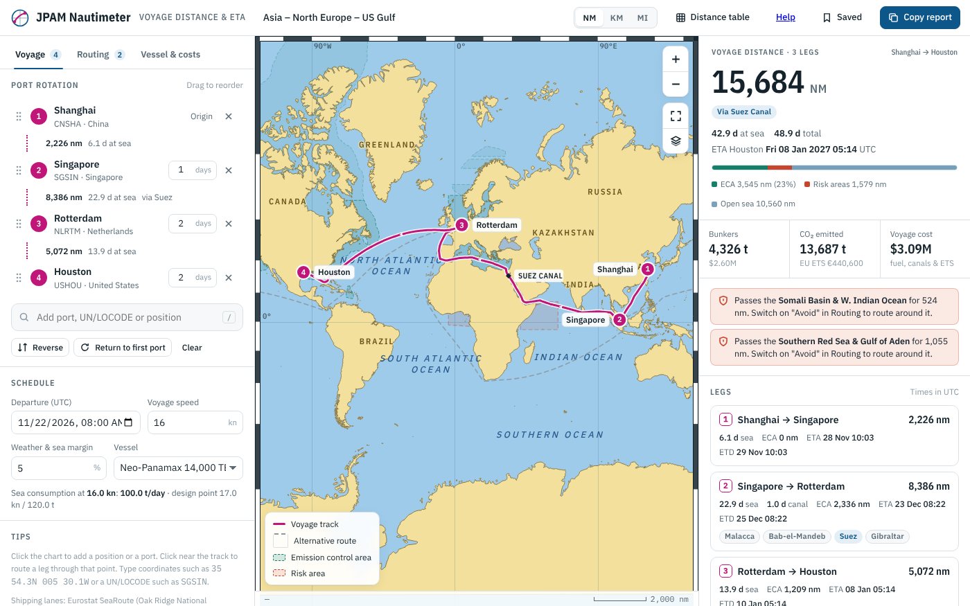
Plan a port rotation and get the sea distance for every leg along real shipping lanes, with the canals and passages you can use, emission control areas, piracy and war-risk areas, ETAs, bunker consumption and the cost of the voyage.
- Free to use
- No account required
- Works offline
Everything in one place.
Real shipping lanes
Distances follow a global shipping-lane network, typically within about 2% of commercial distance tables, with alternative routes shown.
Canals, straits and risk areas
Allow or avoid Suez, Panama, Kiel, the Northern Sea Route and more, route around piracy and war-risk areas, and see the ECA miles on every leg.
Days, bunkers and costs
Speed and weather margin give days at sea and ETAs; the vessel profile gives bunkers, CO₂, canal dues and the EU ETS cost.
Distance tables and reports
Build a distance table between any ports, save voyages on your device, and copy a voyage report to paste into an email.
Three steps and you’re in.
Build the rotation
Add ports by name or UN/LOCODE, or click the chart. Drag to reorder and set the days in each port.
Set the routing
Choose the canals and passages you can use and the areas to avoid, then pick the vessel and speed.
Read the results
See the distance, days, ETAs, ECA miles, bunkers and cost for each leg, then copy the report.
Take a look.
Select a picture to enlarge it. Use the arrow keys or swipe to move between pictures.
Free in your browser
Free to use in your browser, with no ads or account. Works offline after your first visit.
Not for navigation. Distances are for planning, and ECA and risk-area limits are simplified. Check the current JWC listed areas, canal rules and your charterparty. Shipping lanes: Eurostat SeaRoute. Privacy policy.